There are multiple methods to determine when either an object can see land or a vehicle is over land. The main approaches are:
• Deck Access
• Coverage
To use
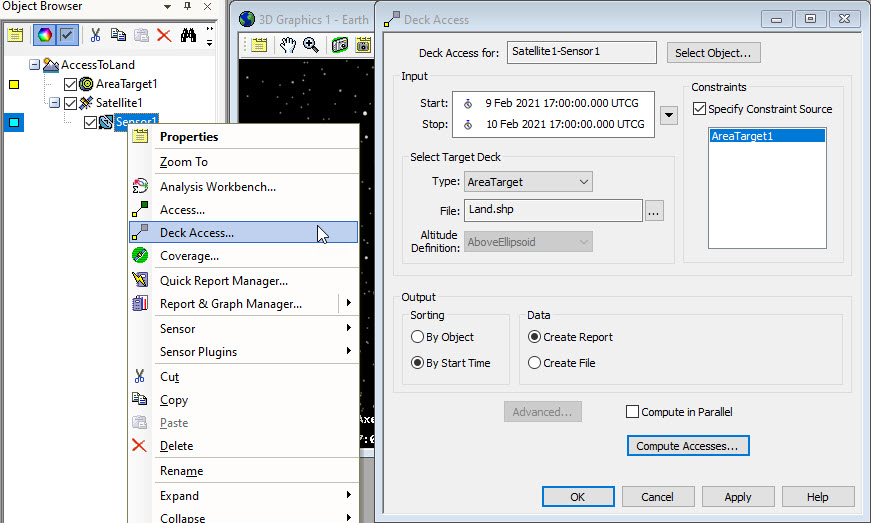
Deck Access, open the Deck Access tool from the object you want to compute access from, set the target deck type to AreaTarget, and select "C:\Program Files\AGI\STK 12\Data\Shapefiles\Land\Land.shp".
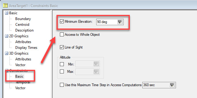
If you want to compute when a vehicle is over land, first create a dummy AreaTarget and set it's Constraint > Basic > Minimum Elevation to 90 degrees.
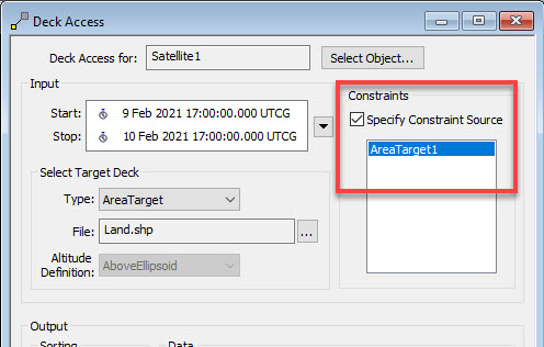
Now apply this constraint to your Deck Access computation by selecting AreaTarget as the constraint source.
You should not load this shape file into STK as AreaTargets and compute access to those, since there are too many AreaTargets contained in this shapefile.
For a
CoverageDefinition, set your coverage region to be the area defined by the "C:\Program Files\AGI\STK 12\Data\Shapefiles\Land\Land.shp" file. Select "Custom Regions" and browse to the Land.shp file from the "Load Regions File ..." button.
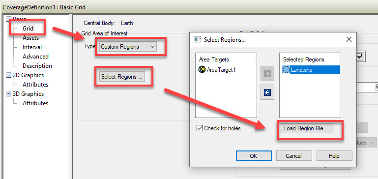
Then compute the CoverageDefinition as usual.

