Suppose that you have a scenario set up with access from a satellite to a facility. To get azimuth and elevation angle data in the satellite's body axes, you need to create the following angles in
Analysis Workbench.
1. Right-click the satellite and choose Analysis Workbench (

).
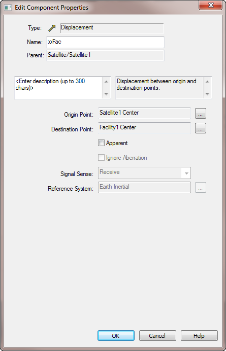
2. Click the "Create new Vector" icon and set the following options. This creates a vector pointing from the satellite to the facility.
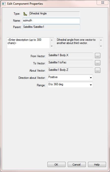
Create a Dihedral Angle
- Click the "Create new Angle" icon.
- Set the following options. This will create the azimuth angle based off the satellite's body X axis and read positive towards the Y axis about the Z axis.
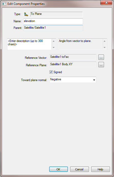
Create an Elevation Angle
Lastly, you can set the elevation angle. This will define the elevation angle referenced to the body X-Y plane as positive along the -Z axis.
- Click the "Create new Angle" icon.
- Set the following options:
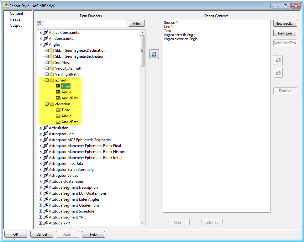
Create a new report style
- Open up the Report and Graph Manager (
 ).
). - Select your satellite as the object type.
- Create a new report style and expand the Angles folder. You'll see the azimuth and elevation angles you just made.
- Select the Time for one and the Angle for both.
- Move these data providers to Report Contents column.
- Click OK.
Generate the report
- Bring the Report & Graph Manager to the front.
- Select the custom report you created.
- Generate the custom report.
You'll see the time and Azimuth-Elevation values in your satellite's body frame. You are not limited to computing the angles to a facility. This method will work with other objects.
