This method requires the Analysis Workbench (AWB) license.
- Insert a default satellite and make sure it is propagated.
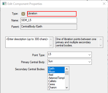
- If you are using any Lagrange point besides Sun-Earth-Moon L1 and L2, the point must be created in Analysis Workbench first.
- Open Analysis Workbench and change the filter to "Primary Central Bodies". On the Vector Geometry tab, select the Earth on the left and click "Create new Point".
- Set the Type to "Libration". Change the Point Type to the desired Lagrange point and select the primary and secondary central bodies for the point. Multiple secondary central bodies can be selected by holding "Ctrl" while clicking.
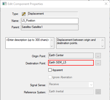
- In Analysis Workbench, change the filter to "All STK Objects". On the left, select the satellite and click "Create new Vector".
- Keep the Type as "Displacement" and the Origin Point as "Earth Center". Click the ellipses next to Destination Point. Change the filter to "Primary Central Bodies" and select your Lagrange Point then click OK. Then click OK again to save the vector. Close Analysis Workbench.
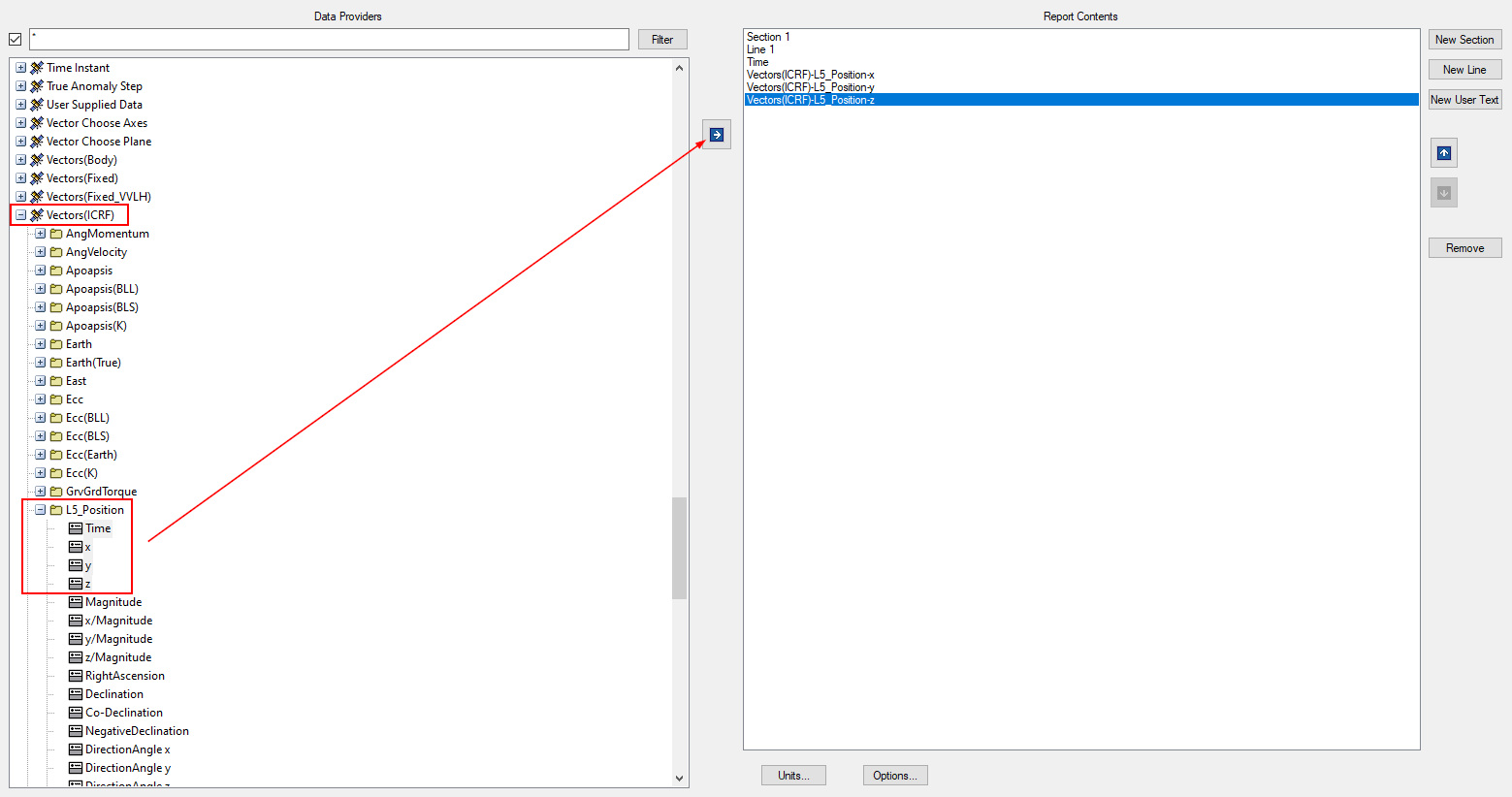
- Right click on the satellite and open Report & Graph Manager. Click the "Create new report style" button, name the report and press Enter.
- Scroll down to the "Vectors(ICRF)" data provider and expand it, then find the folder with the same name as your custom vector and expand that. Move Time, x, y and z to the Report Contents section. Click OK.
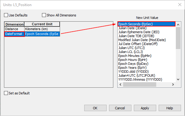
- Generate the new report. This will show the position of the Lagrange point for the scenario analysis time interval. Click the "Report Units" button at the top of the report and change the Date Format units to Epoch Seconds (EpSec).
- Now create the ephemeris file. Open a new text file in Notepad or Notepad++ and copy the following lines and paste them in the top of the file (Set the file version to something older than the STK version you are running).
stk.v.10
BEGIN Ephemeris
CentralBody Earth
CoordinateSystem ICRF
DistanceUnit Kilometers
EphemerisTimePos
- Now copy the data from the report in STK and paste it into the ephemeris file under the "EphemerisTimePos" line. At the very bottom of the file, under the last point, put the line "END Ephemeris" and save the file as "YourFile.e".
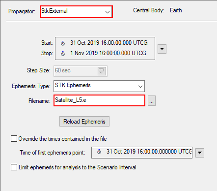
- In STK, open your satellite's properties and change the propagator to "StkExternal". Keep the Ephemeris Type as "STK Ephemeris" and click the ellipses next to Filename. Select your new ephemeris file and click OK. Click OK to save and close the satellite's properties.
Your satellite will now be at the specified Lagrange point for the duration of the scenario! If you are having trouble seeing your satellite, try opening the 3D Graphics Window's properties and changing the Max Visible Distance to 1e+12 km on the Advanced page.

