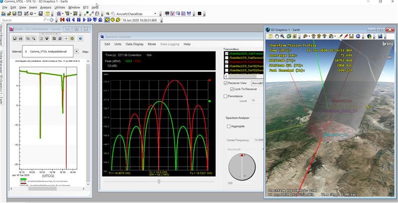
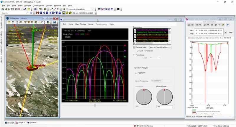
| Answer | Assume you have built a helicopter flight route in STK as in this Aviator VTOL example exercise.Now you want to model interference on a communications downlink to the helicopter from a geostationary satellite. Where is this interference coming from? Does it emanate from unintended interference from downlinks from a large non-geostationary constellation communicating to its subscribers? Does it arise from a saboteur who happens to be hiking up a nearby mountain and has the inclination and knowhow to jam the helicopter?You can build an STK scenario that simulates the relevant portion of the proposed constellation of LEO satellites. Furthermore, the LEO satellites can have two or more spotbeams, each of which can cause individual interference.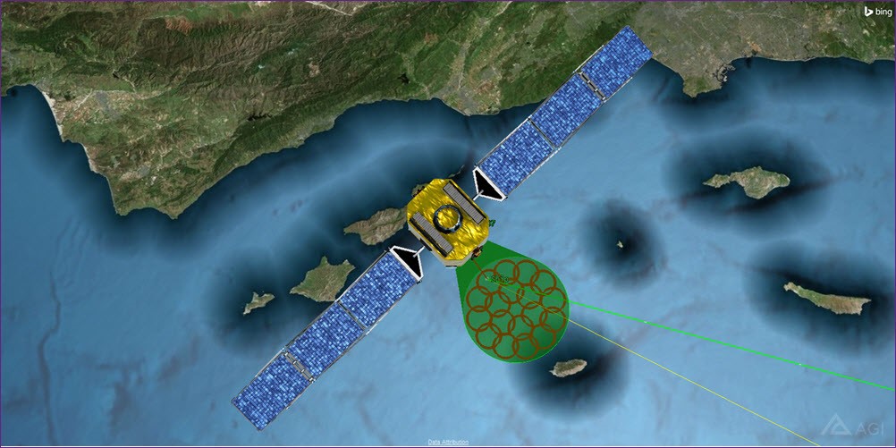 LEO satellite with a spotbeam patternYou can fit the helicopter with a variety of options of antenna types, using either the types inherent in the STK software or by adding others through external means. LEO satellite with a spotbeam patternYou can fit the helicopter with a variety of options of antenna types, using either the types inherent in the STK software or by adding others through external means. 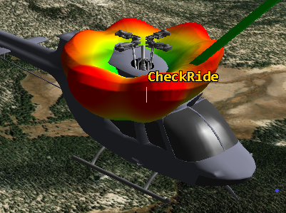 Helicopter with custom-built antenna patternYou can use the Walker tool to build a constellation of identically configured satellites to the appropriate scale. Use the STK CommSystem object to do interference modeling of any combination of potential interferers and jammers.During a limited period of time, you can determine through reports and graphs if any of the satellites interrupt transmissions between a GEO satellite and the helicopter. Use a Spectrum Analyzer to add further light to this analysis by showing the frequency profiles of the GEO signal, interference from the LEO constellation, and the purposeful jamming ground signal as perceived by the helicopter receiver. Lastly, use color contours along the helicopter track to show how strongly or poorly the signal reception can be at any given location. Helicopter with custom-built antenna patternYou can use the Walker tool to build a constellation of identically configured satellites to the appropriate scale. Use the STK CommSystem object to do interference modeling of any combination of potential interferers and jammers.During a limited period of time, you can determine through reports and graphs if any of the satellites interrupt transmissions between a GEO satellite and the helicopter. Use a Spectrum Analyzer to add further light to this analysis by showing the frequency profiles of the GEO signal, interference from the LEO constellation, and the purposeful jamming ground signal as perceived by the helicopter receiver. Lastly, use color contours along the helicopter track to show how strongly or poorly the signal reception can be at any given location.
Multibeam transmitter on a LEO dominates the GEO downlink
Adding a handheld jammer further compounds the issue
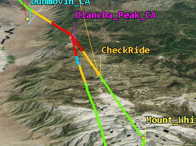
Helicopter route interference coverage
Attached is an example scenario showing this modeling. To see the steps that lead to building this scenario from the Aviator VTOL exercise, check out the attached tutorial. |
|
|---|

